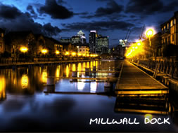
9. Millwall Dock Information & History
The Millwall Dock was constructed by John Aird & Co in 1868. The dock is L-shaped, with an 'Outer Dock' running east-west, and an 'Inner Dock' running north from the eastern end. It originally contained around 36 acres of water and had a 200 acre estate. The western end of the Outer Dock was originally connected to the Thames at Millwall by an 80ft wide channel. The spoil from the docks formed the area of wasteland known as the Mudchute. With reorganisation by the PLA in the 1920s, the northern end of the Inner Dock was connected to the West India Docks by the Millwall Passage, and the direct connection to the Thames was filled. The dock was used mainly for timber and grain, a trade which eventually moved down river to the Port of Tilbury with the construction of a major grain terminal in the 1960s. A McDougall's flour mill on the south side of the Outer Dock was demolished in about 1980. More at wikipedia | Read british-history.ac.uk | Also read millwall-history.org.uk >
View Photos of here and nearby locations | Buy Prints


